Kings Canyon
Kings Canyon
Sandstone gorge in Watarrka National Park, Kings Canyon is explored on foot via the Rim Walk and Garden of Eden, 450 km southwest of Alice Springs.
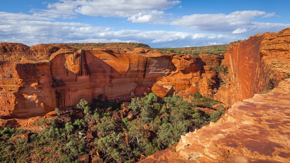
Kings Canyon is a sandstone gorge located in the Watarrka National Park, south of Australia's Northern Territory. Its red walls, rising hundreds of metres high, mark a defining feature of the Red Centre, approximately 450 km southwest of Alice Springs. The site is explored on foot via several trails of varying difficulty, and remains accessible for much of the year outside peak summer months.
Why visit Kings Canyon
Kings Canyon offers a singular geological landscape: a sandstone chasm approximately 270 m deep according to park surveys, framed by cliffs, wind-eroded domes and a permanent water source hidden between the walls. Less crowded than Uluru, more rugged than the MacDonnell Ranges, it forms a natural stop on the loop connecting Alice Springs to Yulara. Hikers will find moderate to challenging terrain; travellers on organised tours typically spend half a day here.
The site's history
The Luritja Aboriginal people have inhabited the Red Centre for over 20,000 years. They came to Kings Canyon to source water and conduct ceremonies, the site maintaining cultural significance for their descendants today.
In 1872, explorer Ernest Giles became the first European to reach the canyon. He named it after his friend Fielder King. The area, part of Tempe Downs station, remained isolated without a proper road access until the early 1960s.
In 1961, Jack Cotterill acquired land at Angas Downs Cattle Station, approximately 100 km from the canyon, and built the Wallara Ranch, the region's first ranch. From Alice Springs, he organised the area's first guided visits, originally conducted as three-day expeditions. Cotterill passed away in 1978; the ranch was later abandoned and demolished roughly a decade later. According to park estimates, visitation reached approximately 60,000 visitors annually by the 1990s.
What to see and do
The Kings Canyon Rim Walk
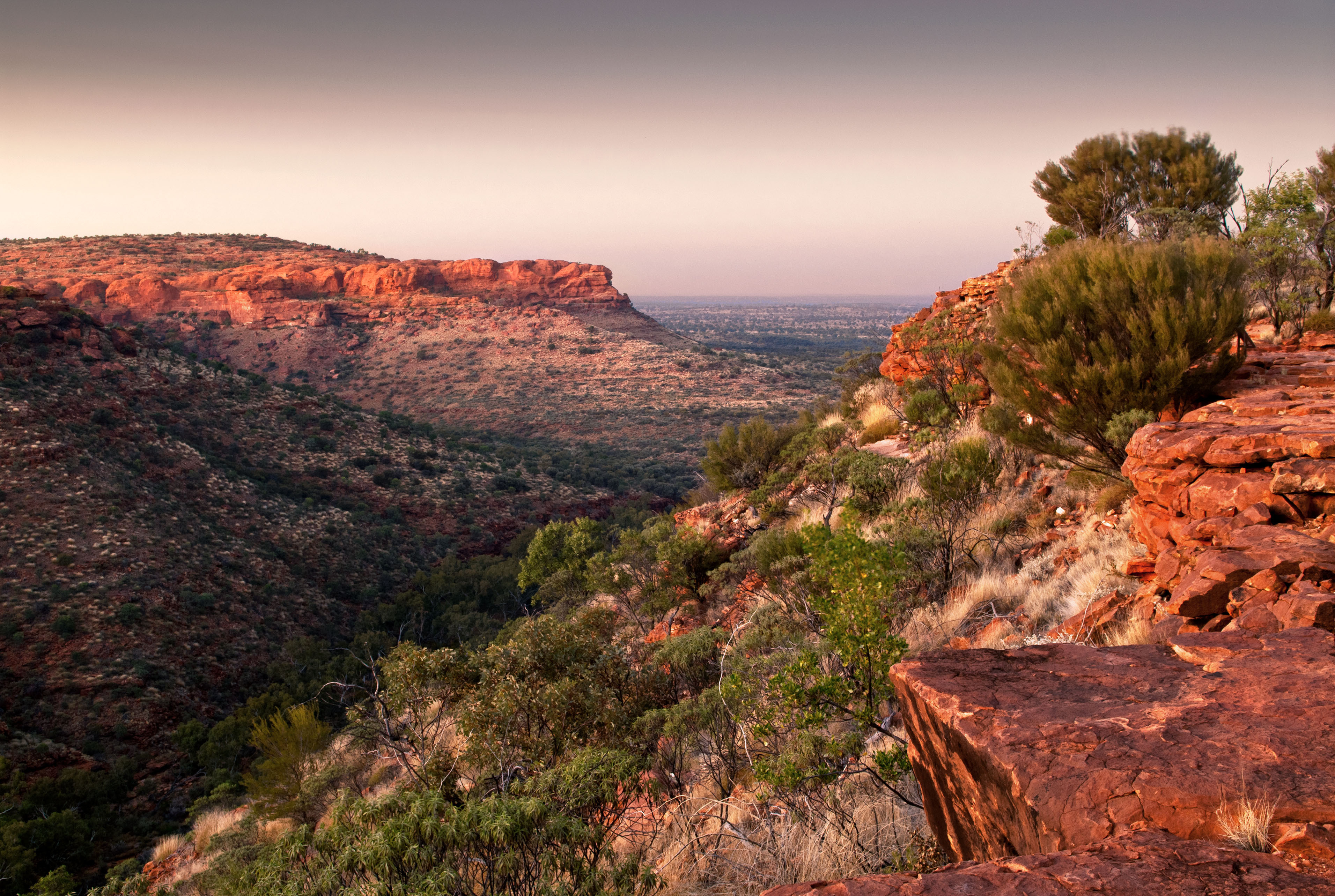
The park's signature trail, the Rim Walk circles the canyon from above over approximately 6 km, allowing 3 to 4 hours of walking depending on pace and stops. The start features a steep ascent; the remainder follows the rim with sweeping views down into the chasm. The trail also passes through the Lost City, a collection of sandstone domes shaped by wind and water erosion.
The Garden of Eden
At the heart of the route, the Garden of Eden is a permanent water source nestled between the walls. You'll observe cycads, palms, goannas, snakes and frogs. Swimming is discouraged out of respect for the site's meaning to Aboriginal communities.
Kings Creek Walk and Giles Track
Shorter and more accessible, the Kings Creek Walk follows the creek bed upstream through eucalypts and ferns to a vantage point overlooking the cliffs. For independent, well-equipped walkers, the Giles Track connects Kings Canyon to Kathleen Springs over 22 km.
Kings Creek Station
35 km from the canyon, at the foot of the George Gill Range, Kings Creek Station is a cattle and camel station. The station offers camel rides, quad outings across dunes and spinifex plains, plus accommodation in camping facilities or safari cabins.
Scenic flights
Departing from Kings Creek Station, helicopter flights soar over the canyon, the Garden of Eden, Carmichael Crag and the Kathleen Springs area. An option to grasp the park's scale in addition to hiking.
Practical information
- Water: bring several litres per person minimum on the Rim Walk; few water sources along the route.
- The Rim Walk may close during extreme heat (typically above 36 °C early in the day).
- Accommodation concentrated around Kings Canyon Resort and Kings Creek Station; booking recommended during peak season.
- Fuel is scarce on the road; fill up whenever possible.
When to visit
The ideal period runs from April to September, when daytime temperatures remain manageable for hiking. The Australian summer (December to February) brings intense heat, poorly suited to multi-hour walks.
How to get there
Kings Canyon is most commonly reached from Alice Springs, approximately 450 km away. The route takes the Stuart Highway south, then the Lasseter Highway west and finally the Luritja Road north. The roads are sealed and well-maintained, but distances are long and services sparse. The canyon can also be included in a loop connecting Uluru-Kata Tjuta, as most organised tours do.
Nearby
Kings Canyon fits into a broader itinerary through the Australian Outback. Here are some stops to consider to round out your journey:
- Alice Springs: hub city of the Red Centre, the logical starting point for reaching the park.
- Cradle Mountain National Park: another major Australian natural area, in Tasmania.
- Maria Island: Tasmanian island renowned for its wildlife and coastal landscapes.
Frequently asked questions
Frequently asked questions
Allow at least half a day for the Rim Walk (3 to 4 hours of walking) and a full day if you wish to add the Kings Creek Walk or an activity at Kings Creek Station.
The initial climb, nicknamed Heart Attack Hill, is steep and exposed. The rest of the route is generally flat but long, covering 6 km. The trail suits hikers in good condition, with water and a hat.
Swimming is discouraged out of respect for Luritja Aboriginal communities, for whom the site holds cultural significance.
By car, allow approximately 450 km via the Stuart Highway, Lasseter Highway then Luritja Road, taking 5 to 6 hours of driving. Organised excursions from Alice Springs typically include the canyon within a loop towards Uluru.
April to September, when daytime temperatures allow comfortable walking. In summer, certain trails close during extreme heat.
Planning your trip
Kings Canyon fits naturally into an itinerary combining the Red Centre, Uluru and Top End landscapes. To build your bespoke journey, explore our Australie travel ideas.
Interested in this visit?
We can include it in your personalised itinerary.