Mount Wellington (Kunanyi)
Mount Wellington (Kunanyi)
Kunanyi / Mount Wellington stands at 1,271 m above Hobart. Dolerite columns, 360° panoramic views over the Derwent Estuary and historic trails make this massif an essential stop in Tasmania.
Kunanyi / Mount Wellington dominates Hobart at 1,271 metres altitude. This dolerite massif, visible from nearly everywhere in the city, offers a 360° panorama over the Derwent Estuary, Hobart's suburbs and, on clear days, Tasmania's peaks. The mountain is both a protected natural space and a powerful symbol of identity for locals.
Quick practical facts
- Summit access: sealed road open to private vehicles (Pinnacle Road) — free access.
- Public transport: seasonal shuttle from Hobart CBD (check availability with the local visitor centre).
- Recommended duration: 1 hour at the summit; allow a half-day if hiking is included.
- What to wear: warm and waterproof clothing essential — weather changes rapidly, even in summer.
- Accessibility: the summit lookout is accessible by vehicle; hiking trails are natural, unmaintained terrain.
What to see
At the summit, the lookout offers clear views across Hobart, the port and Tasman Peninsula. Hexagonal columnar dolerite formations dominate the landscape. Below, eucalyptus and Huon pine forests alternate with alpine moorland. During snow — possible in winter — the mountain transforms entirely.
History and context
The Muwinina people frequented these slopes for millennia before British colonisation. The name Kunanyi, in the palawa kani language, has been officially recognised since 2013 alongside the English name. French naturalist Labillardière was among the first Europeans to describe the mountain during the d'Entrecasteaux expedition in 1792. The summit has been accessible by vehicle since the 1930s.
Highlights of your visit
The Pinnacle lookout
The highest point at 1,271 m is sheltered by a stone structure built in the 1930s. On clear days, views extend to Bruny Island and Tasmania's inland ranges. The wind can be fierce: bring an extra layer.
The dolerite columns
The basalt-like dolerite organs that crown the summit rank among Tasmania's most spectacular formations. These geological features, formed by slow magma cooling, reach several metres high and structure the entire Pinnacle landscape.
The hiking trails
Several marked routes start from Hobart CBD or intermediate car parks. The Organ Pipes Track traces the great rock columns. The historic Zig Zag Track connects South Hobart to the summit through dense forest.
Photography tips
Golden morning light illuminates the dolerite columns from the east, revealing their texture. Late afternoon bathes Hobart in sunset glow — perfect for sweeping views over the estuary. Partial mist days create striking atmospheres as clouds cling to the cliffs. Drones are subject to CASA regulations: verify authorised zones before flying.
Location and access
Kunanyi / Mount Wellington lies about ten kilometres west of Hobart CBD. Pinnacle Road, accessed from Fern Tree, climbs to the summit. By car, allow around 30 minutes from the CBD. Seasonal shuttles operate; check with Hobart visitor centre for current schedules. Fern Tree, at the mountain's base, is a good starting point for hikers.
Nearby attractions
- Salamanca Place — Saturday morning market and art galleries in 19th-century waterfront warehouses.
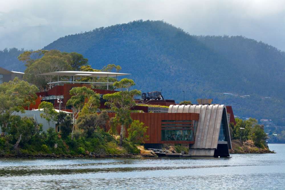
- MONA (Museum of Old and New Art) — provocative contemporary art museum built into a cliff overlooking the Derwent, a few kilometres north.
- Battery Point — historic precinct of 19th-century cottages at the port's edge.
- Tasman Peninsula — spectacular sea cliffs and Port Arthur, about 1.5 hours' drive.
Frequently asked questions
The summit is accessible year-round. Australian summer (December–February) offers the best chance of clear skies. In winter, snow may temporarily close Pinnacle Road; check conditions before departing.
Vehicle access via Pinnacle Road is free. No entry fee is charged for hiking trails.
Even in summer, the summit can be cold, windy and cloudy. Always bring a waterproof jacket and warm layers, regardless of city weather.
Yes. A half-day covers the summit; the afternoon can be spent at Salamanca Place or MONA, both easily reached from the CBD.
Drones are subject to CASA (Civil Aviation Safety Authority) regulations. Some zones near the summit may be restricted; consult the airspace map before flying.
Several local operators offer guided excursions from Hobart, sometimes including a commentary hike on historic trails. Hobart's visitor centre can direct you to active providers.

Interested in this visit?
We can include it in your personalised itinerary.