Cape Raoul
Cape Raoul
A promontory on the Tasman Peninsula featuring striking dolerite cliffs, Cape Raoul is explored via a 14 km hike accessible from Port Arthur.
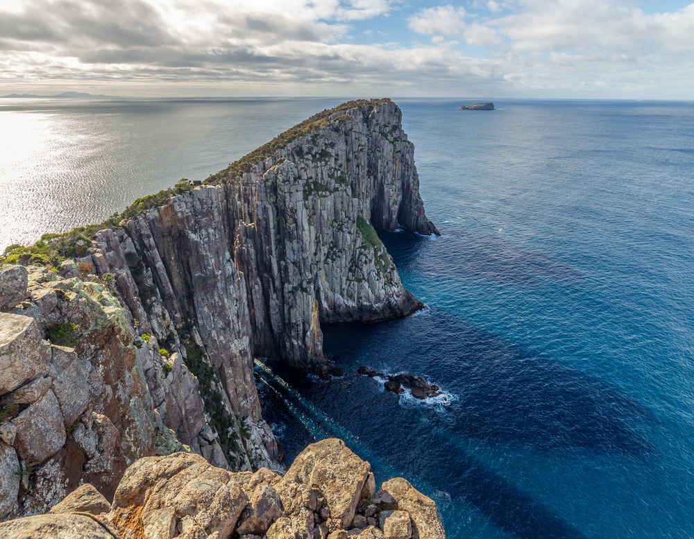
Cape Raoul is a promontory located at the south-western tip of the Tasman Peninsula, in south-eastern Tasmania. Part of Tasman National Park, it stands out for its dolerite cliffs that plunge vertically into the Tasman Sea and for a singular cartographic history intertwining French and British explorers. Today, the site is renowned for its day hike, accessible from Port Arthur.
Why visit Cape Raoul
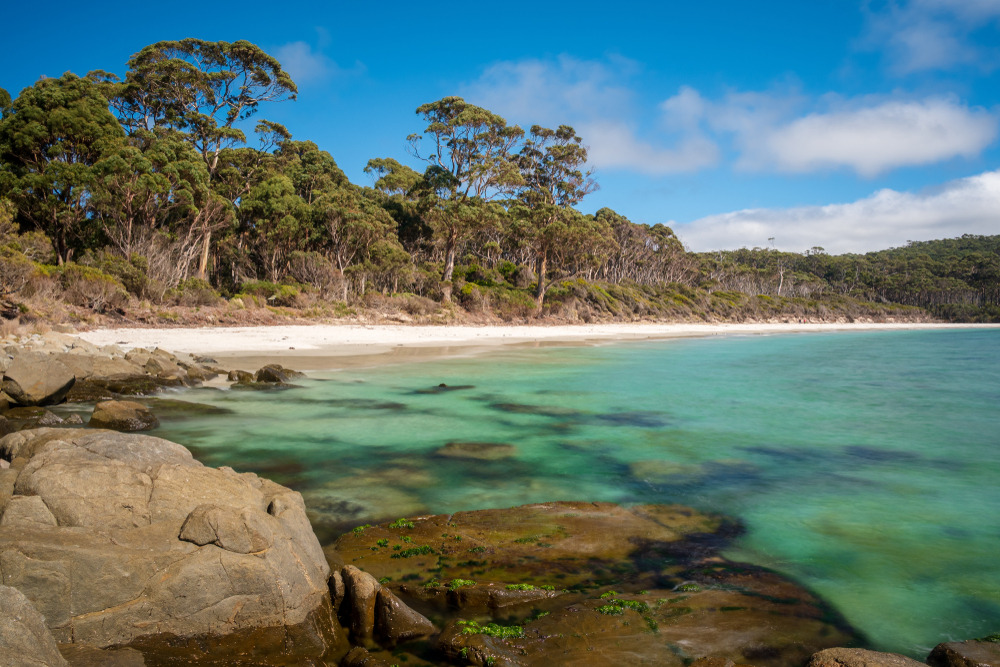
The Cape Raoul trail ranks among Tasmania's most celebrated hikes. It combines several rare elements: dolerite cliffs among Australia's highest, a seal colony visible from the terminal lookout, and expansive views over the Southern Ocean. The walk traverses a eucalyptus forest before opening onto a rocky plateau that tapers to a point above the sea.
The site remains relatively sheltered from mass tourism compared to other Tasman Peninsula highlights, due to the final access via dirt road and the hike's length.
History and naming
The cape takes its name from the French expedition of Bruny d'Entrecasteaux, who sailed off Tasmania's coast in the late 18th century. It was named after the expedition's pilot, Raoul. Years later, British navigator Matthew Flinders, struck by the dark colour of the rock formations, designated it "Basaltic Cape" on his early surveys.
In 1814, after consulting French charts, Flinders ultimately adopted the name "Raoull" on his own documents, a gesture acknowledged by the Count de Fleurieu in France. The dual nomenclature nevertheless persisted for several decades: cartographers such as Scott, Cross and Arrowsmith continued using one name or the other, sustaining confusion that only gradually dissipated. Cape Raoul remains a quiet testament to this period of competing exploration between France and Britain in Australian waters.
The hike and what to see
The Cape Raoul trail ranks among Tasmania's 60 great walks. It is a return journey of approximately 14 km, taking around 5 hours, at moderate difficulty level.
- The route: gradual ascent through sclerophyll forest, then opening onto an exposed rocky plateau.
- Dolerite cliffs: vertical columns characteristic of the Tasman Peninsula, among the country's highest.
- Marine wildlife: seals are frequently spotted from the lookouts, clustered on rocky islets below.
- Shipstern Bluff: this internationally renowned surf break, known for its massive waves, is sometimes visible from the trail's upper reaches.
- Viewpoints: several stops allow rest before the terminal lookout at the cape's tip.
Practical information
The hike requires careful preparation, as the trail is exposed to wind and sun on its upper section:
- Equipment: sturdy hiking boots, sufficient water (1.5 to 2 L), windproof jacket, sun protection, snacks.
- Safety: do not approach cliff edges, the rock is crumbly in places. Check weather before departure, fog can roll in quickly.
- Duration: allow a full half-day on site, or more with photo breaks.
- Park access: Tasman National Park requires a Tasmanian Parks Pass, obtainable online or at visitor centres before your visit.
- Mobile coverage: very limited on the trail; inform someone of your itinerary.
Best time to visit
The most favourable period runs from November to April, during the Southern summer and early autumn. Temperatures are moderate, days are long and conditions more stable. Tasmanian weather nonetheless remains changeable year-round: it is not uncommon to experience sun, wind and rain in a single day. Winter (June-August) is walkable but the trail may be muddy and winds violent at altitude.
How to get there
Access is by car only, via the Tasman Peninsula:
- From Port Arthur or Nubeena: take the B37 road westward for approximately 8 km, to the sign for Highcroft and Stormlea, just after Parsons Bay Creek.
- Stormlea Road: turn and follow this road for approximately 9 km of dirt track to the hike's starting car park.
The track is passable in a standard vehicle in dry conditions, but features tight bends. Watch for wildlife (wallabies, possums) frequently crossing the road, especially at dawn and dusk.
Nearby attractions
The Tasman Peninsula concentrates several sites complementary to a Cape Raoul visit:
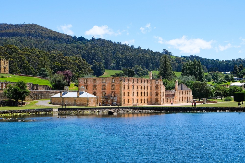
- Port Arthur and its historic penitentiary site, about twenty minutes' drive away.
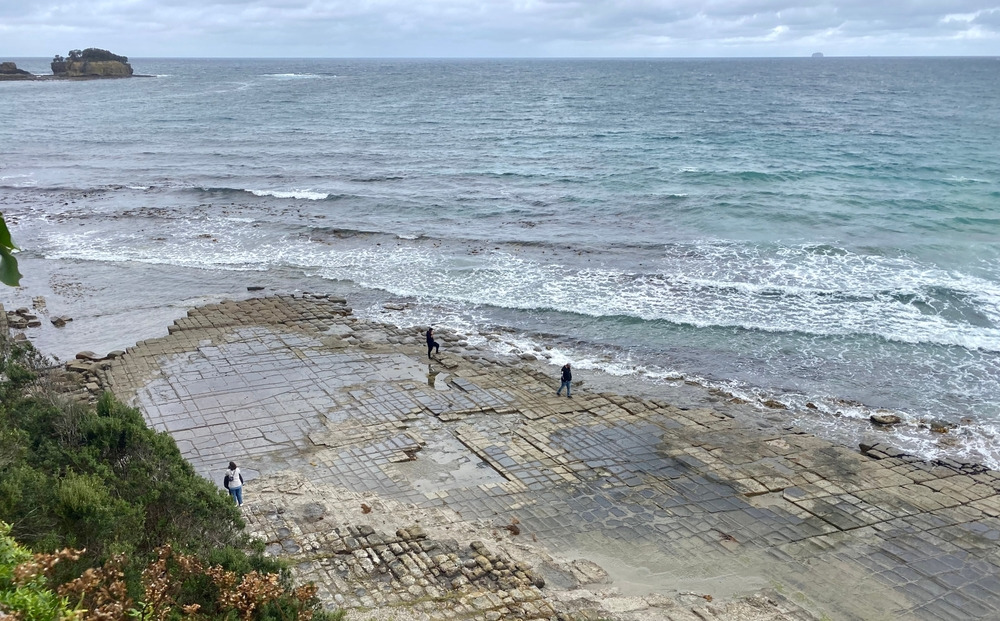
- Eaglehawk Neck, the narrow isthmus connecting the peninsula to the rest of Tasmania, known for its geological formations (Tessellated Pavement, Tasman Arch).
- To extend your exploration of Tasmanian nature, Cradle Mountain National Park, further north-west.
Frequently asked questions
Frequently asked questions
The level is rated as moderate. The distance (14 km return) and duration (approximately 5 hours) require good fitness, but elevation gain is modest. Occasional hikers accustomed to day hikes can consider it.
Yes, a Tasmanian Parks Pass is required to access the park. Various options exist (daily, weekly, annual) available online or through agencies before your visit.
Seals are frequently observed on the rocky islets below the lookout, but their presence depends on sea conditions. Bring binoculars to spot them more clearly.
Yes, the trail is maintained and marked by Tasmania's Parks and Wildlife Service. It remains wise to bring a map or offline hiking app, as mobile coverage is limited.
No. You must carry all necessary water from the car park, approximately 1.5 to 2 litres per person depending on season.
Planning your hike at Cape Raoul
Cape Raoul naturally integrates into a Tasmania circuit combining penitentiary heritage, coastal hiking and endemic wildlife. To build a custom itinerary including the Tasman Peninsula and the island's other national parks, consult our Australie travel suggestions.
Interested in this visit?
We can include it in your personalised itinerary.