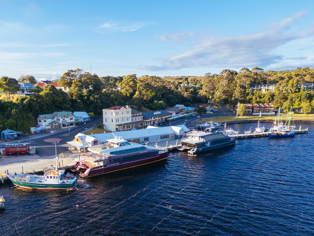
Tasman Peninsula
Tasman Peninsula
Between the UNESCO-listed penitentiary ruins of Port Arthur and the vertiginous cliffs of Tasman National Park, Tasman Peninsula concentrates colonial history and Australian wilderness just 1.5 hours from Hobart.
Tasman Peninsula juts into the Southern Ocean southeast of Tasmania, connected to the rest of the island by the narrow Eaglehawk Neck isthmus. This stretch of land concentrates some of Australie's highest cliffs, a wild coastline carved by waves, and Port Arthur Historic Site, a former penal colony inscribed in UNESCO's World Heritage.
Quick Facts
- Access: approximately 1.5 hours' drive from Hobart via the Arthur Highway (A9).
- Transport: car recommended; no regular public transport link from Hobart.
- Suggested duration: 1 to 2 days to combine Port Arthur, coastal hikes, and viewpoints.
- Port Arthur Site: paid entry (check official website for current rates); includes optional evening ghost tour.
- Tasman National Park: national park pass required for certain areas.
What You'll See
The peninsula presents two complementary faces. On the history side, Port Arthur's penal site comprises dozens of ruined and restored buildings dating from the British colonial era. On the nature side, Tasman National Park unfolds dolerite cliffs plunging sheer into the sea, rock arches, sea caves, and isolated beaches accessible only on foot or by kayak.
History and Context
From 1830, British colonial authorities chose the peninsula to establish a maximum-security prison. The Eaglehawk Neck isthmus, just tens of metres wide, was guarded by dogs and soldiers, making escape virtually impossible. Port Arthur housed thousands of convicts until its closure in 1877. In 1996, the peninsula witnessed a national tragedy that left a lasting mark on Australie. The site was inscribed in UNESCO's World Heritage in 2010 as part of Australie's penal sites.
Highlights of Your Visit
Port Arthur Historic Site
The penitentiary, Gothic ruin chapel, museum, and 1996 victims' memorial form a dense complex. Period-costumed guides animate certain areas. A boat tour around the Isle of the Dead rounds out the experience.
Cape Hauy and Tasman Cliffs
The Cape Hauy trail (roughly 4 hours return from Fortescue Bay car park) leads to vertiginous dolerite columns plunging into the ocean. It's one of Tasmania's most spectacular coastal hikes.
Eaglehawk Neck and Tessellated Pavement
At the peninsula's entrance, the Tessellated Pavement is a natural rock formation whose regular slabs mimic tiling. Accessible in minutes from the car park, it's often paired with views across the isthmus.
Tasman Arch and Devil's Kitchen
These two geological formations, located near each other on the east coast, illustrate marine erosion at work on limestone and dolerite. Secure viewing platforms allow you to approach the precipices.
Sea Kayaking
Several operators offer sea kayak outings from Fortescue Bay to explore sea caves and arches inaccessible on foot. Marine wildlife—dolphins, seals, seabirds—regularly put in an appearance.
Photography Tips
Golden morning light is ideal on Port Arthur's eastern-facing ruins. For Cape Hauy's cliffs, opt for midday when sunlight catches the columns head-on. Tessellated Pavement photographs best at low tide, when the pools fill with water. Avoid thick fog days on the coast: distances deceive, and cliffs lose their relief.
Location and Access
Tasman Peninsula lies roughly 100 km southeast of Hobart. The Arthur Highway (A9) is the only road access. Eaglehawk Neck isthmus marks the peninsula's entrance. Port Arthur Historic Site sits at the southern tip. Guided bus tours departing Hobart are offered by several local operators for those preferring not to drive.
Nearby Attractions
- Hobart — Tasmania's capital, about 1.5 hours away, the natural base for exploration with Salamanca Market and MONA.
- Tasman National Park — encompasses most of the peninsula's wild coastline, with trails and kayaking.
- Eaglehawk Neck — historic isthmus with Tessellated Pavement and Tasman Arch formations.
- Fortescue Bay — remote bay, launch point for hikes to Cape Hauy and Cape Pillar.
Frequently asked questions
Australian summer (December to February) offers the longest days and most stable conditions for hiking and kayaking. Spring (September-November) is quieter and wildflowers bloom. Winter is cold and windy, but Port Arthur stays open and crowds thin out.
A car is strongly recommended for free access to the various sites (Cape Hauy, Tessellated Pavement, Tasman Arch). Organized tours from Hobart exist, but they limit on-site time and hiking options.
Allow at least half a day to explore the site at your own pace. A full day lets you include the boat tour around the Isle of the Dead and, optionally, the evening ghost-tour experience.
The trail is rated moderate to difficult: significant elevation gain, sometimes rocky terrain, roughly 4 hours return. Good hiking boots and plenty of water are essential. Not recommended in heavy rain or strong wind.
Yes, Port Arthur and surrounds offer accommodation ranging from camping at Fortescue Bay to cottages and hotels near the historic site. Book ahead in summer.
Photography is permitted throughout most of the site. Some memorial areas relating to the 1996 tragedy invite discretion; signs on-site indicate any restrictions.
Want to discover this destination?
Our local advisors design your tailor-made trip.